Contact Margaret Burt today for more information
About This Neighbourhood
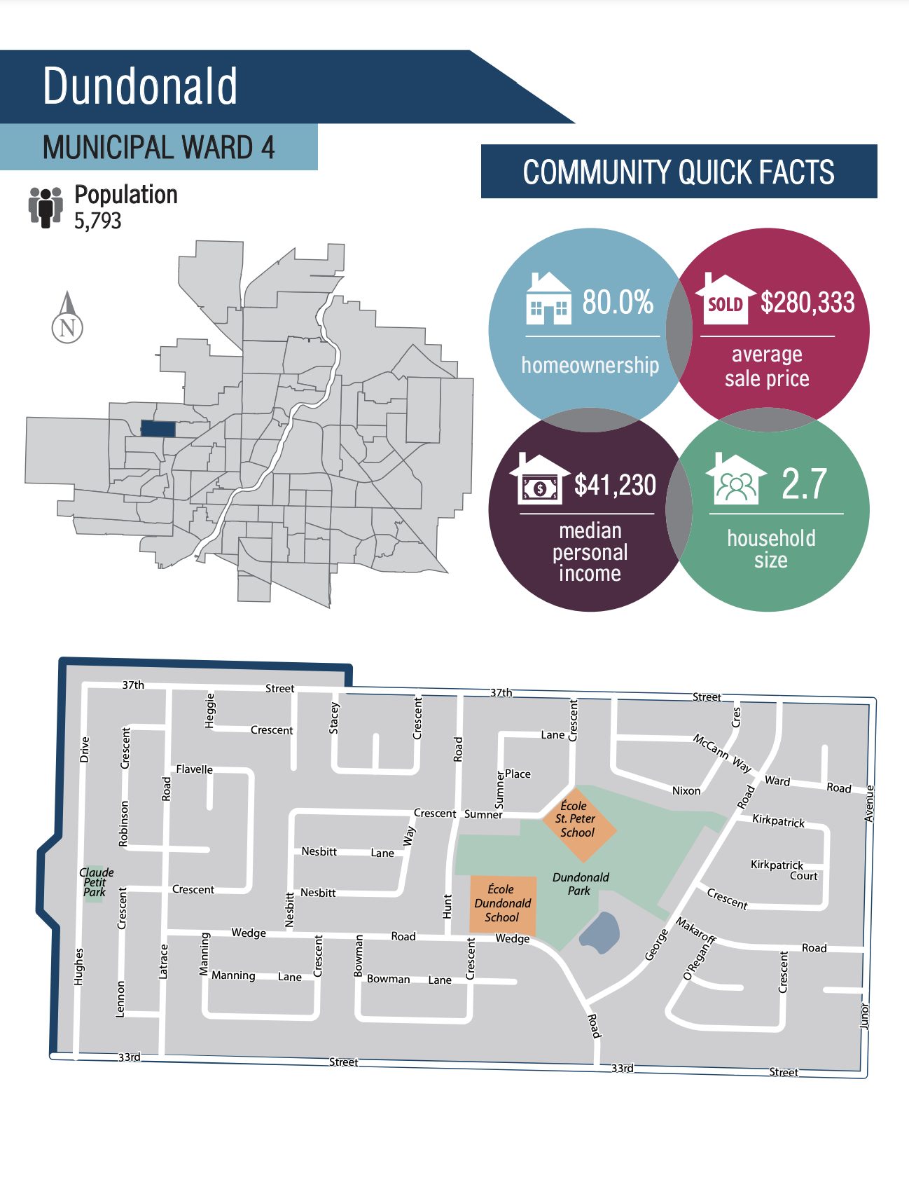
Found in the northwest corner of Saskatoon, Dundonald was the last neighbourhood developed in this area of the city before Hampton Village's addition. It currently has a population of close to 5,800 people and an average home price of just over $280,000.
The land was annexed for Dundonald between 1975 and 1979, and construction began in the early to mid-1980s and reached full build-out in the mid-1990s. The community is named after Dundonald Avenue, a major arterial street that for years marked the western boundary of development in Saskatoon. The construction of the Circle Drive freeway resulted in Dundonald Avenue being removed between 11th and 33rd Streets. This left behind two segments of the roadway, with the northern segment forming the eastern boundary of this community. When construction got underway on the neighbourhood the northern stretch of this Avenue was renamed Junor Avenue in honour of Don Junor, a longtime businessman and civic leader in Saskatoon who was also a city councillor, which fit the criteria for street naming in the community.
The boundaries of this community are 33rd Street to the south and 37th Street to the north and there are no other numbered streets throughout the neighbourhood. Originally, the grid layout was going to continue before the city decided to develop with the crescents and cul-de-sac layout instead. Junor Avenue marks the eastern boundary, Hughes Drive serves as the western boundary, 37th Street is the northern boundary and 33rd Street serves as the southern boundary.
The street names honour former City councillors.
Amenities
• Convenience Store
• 2 Schools - École Dundonald School & St. Peter School
• 2 Parks - Dundonald Park & Claude Petit Park
• Close proximity to Confederation Mall
• Easy access to Circle Drive via 33rd Street W

